It was a damp October weekend, and I hadn’t been walking for a few weeks.
So having read about crash sites in Derbyshire, the B29 Superfortress site on Bleaklow caught my eye as there is plenty of recognisable debris from the crash.
I have seen a couple of crash sites on Kinder Scout, and to be honest, those crash sites could have been washing machines for all I knew, but this one on Bleaklow looked interesting, and made for a good 9 mile trip.
I arrived at the industrial end of Old Glossop early Saturday morning, parking on Shepley street near the bus turning circle. There is plenty of free parking here as it’s situated in a non residential area. Today I was going for a solo walk to find the crash site on Bleaklow. Following the ‘Doctor’s Gate’ path which at one time was a late medieval horse path built between 1494 and 1535 and financed by Doctor Talbot a vicar of Glossop.
The route starts right from the bus turning circle as a farm track and takes you passed farmland beyond Mossy Lea Farm, the path then peels off the track running into the Clough following the running waters of Shelf Brook.
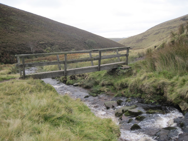
After gaining a little height, the path drops down to the brook and a bridge is crossed.
Clouds obscure Higher Shelf Stones
The bridge crossing Shelf Brook
After gaining a little height, the path drops down to the brook and a bridge is crossed.
It’s a bit of a long slog from here, the path disappears in boggy sections and had me standing on a spot, working out my next driest course of direction.
Height is slowly gained and the path changes from the wet mushy bog lower down to a stoney limestone path as I get closer to the end of Doctor’s Gate.
Wet boggy ground in the lower section of Doctor's Gate
The path in a small area is breaking away due to rainfall
Looking back down Doctor's Gate
Bad weather looms over Higher Shelf Stones. Crooked Clough can be seen to the right of photo
My aim was to take a path north east along ‘ Crooked Clough’ before Doctor’s Gate joined the ‘Pennine Way’ the path isn’t well established and the junction is marked by a small cairn, but this is the easiest way to ‘Higher Shelf Stones’ my next target on my route.
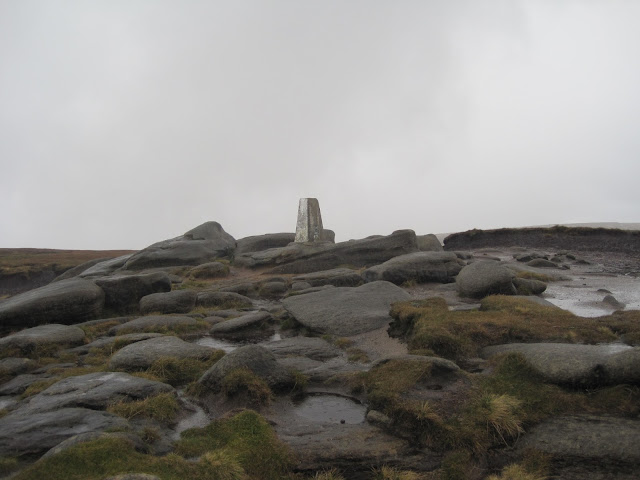
The path crosses the brook at the head of the Clough and from here it’s just a short ascent up to the trig point of ‘Higher Shelf Stones’ 621m.
Inscriptions on Higher Shelf Stones
Although overcast all morning, the rain had held off until now. I tried to take shelter as best as I could in order to take a drink and have a snack. It was cold, wet and uncomfortable, so after a quick stop I headed away from the trig. I should have taken a north east compass heading and within a minute I’d be walking amongst the crash site, however I headed north, and completely missed the site.
Hern Stones
Now Bleaklow isn’t called Bleaklow for no reason. It really is bleak up here on a dull overcast day, wild, rugged and can be unforgiving. The tops of this moorland are covered with peat groughs, some as deep as 3m which make it difficult to traverse. Navigation is needed even in fine weather as walking a straight line route of any distance over this landscape is almost impossible.
Negotiating the huge peat hags was difficult and disorienting as I manoeuvred my way around them and back up to the higher ground, checking my bearings each time.
Passing ‘Hern Stones’ a walker crossed my path, and I ask him about the crash site. Luckily he knew exactly where the site was and pointed me to the spot in the distance. With a thanks, we parted in different directions.
Now my plans had to change as I wanted to visit Wain Stones and ‘Bleaklow Head’ as well as the crash site.
So I continued on my heading north to Wain Stones. Standing at the correct angle, these stones appear to be kissing, which is why they are also known as the ‘Kissing Stones’ from here it’s a NNE heading for Bleaklow Head which is marked by a pile of stones and a pole.
Wain Stones (Kissing Stones)
Bleaklow Head 633m
From here I returned pretty much on the same route back towards ‘Higher Shelf Stones’ keeping slightly east through thick peat bog and deep groughs, but at least it had stopped raining.
Eventually I arrived at the crash site of the B29 Superfortress bomber. I have to say this is an amazing place, but also a sad place. The first thing I saw were the peat banks, covered with placed poppy crosses. Then the large undercarriage with remnants of rubber still around the wheels. A huge section of wing and many loose pieces of metal lay in the peat.
A stone memorial sits at the site to mark the 13 men killed when the bomber named ‘Over Exposed’ crashed into the moor.
I stood for a few moments to pay my respects before leaving the site and making my way on a heading northwest to ‘Dowstone Clough, picking up a faint path along the way.
I crossed the waters of Yellow Slacks Brook before descending Harrop Moss. This path brought me down to the Doctor’s Gate track and back to Old Glossop and the car.
Yellow Slacks


