Saturday 18 November 2017

Troutbeck


A drive in darkness up to the Lake District is one of the down sides to a good long day trip out in November, but 6.30am Saturday morning my rucksack was packed, car boot full and I was away M6 bound. 
With little traffic on the road my old reliable Kia had no trouble eating up the road and just under two hours later I was pulling up at a planned free parking spot in Troutbeck close to the church, right on time.


The route I was taking was Sour Howes via the Garburn Pass, Sallows and Troutbeck Tongue, and perhaps Baystones, which would be about 10 miles.

The weather forecast was for a couple of showers early in the day then a bright afternoon. So as I left the car to the sound of an early morning cockerels chorus from a nearby farm I expected the rain not to be very far away, but in fact it never came.


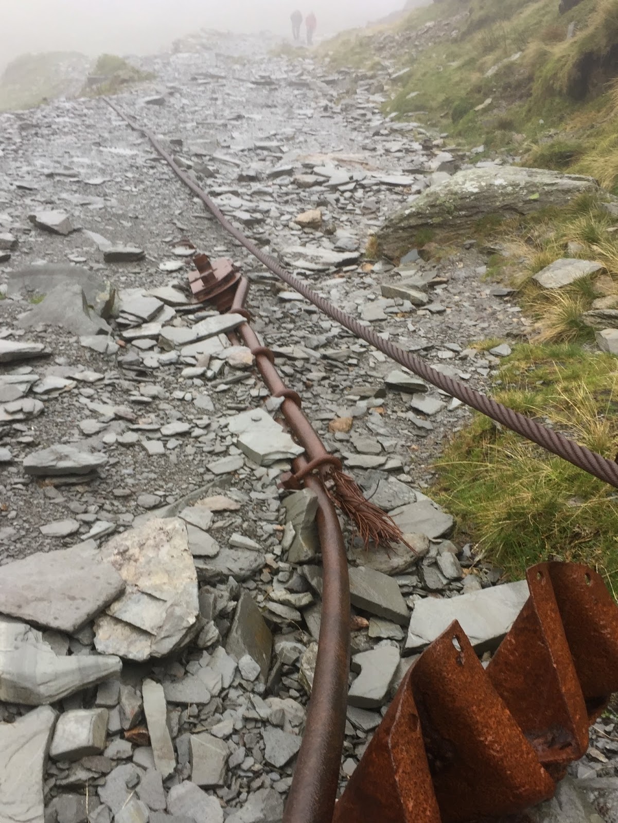
Looking back down the route leading to 'The Howe' with the sound of cockerels filling the fresh morning air. 

I have got to say, these fells did not inspire me reading the notes from Wainwright's guide book, he didn't spend too long on them and wasn't impressed, but I want to explore all areas of the Lakes and experience them for myself, but I really wasn't overly excited about the day in front as I normally am.

The climb up the stoney Garburn Pass is a gentle one to start with, fine views across the Troutbeck valley soon open up.
But then leaving the pass bridleway to then climb the grassy side of Sour Howes becomes a little steep and today it was slippery in the damp conditions.
The full height of the fell is soon gained, but there are a number of lumps and humps on top, which at first glance looks like any one of them could be the summit.
But following a rough path between the grass humps brings you to one with a very small pile of rocks, and having checked my GPS altimeter reading of 483m I was happy I was on top of the true summit of Sour Howes. I think for me, there's a bit of a purest trying to get out, as getting roughly to the top of a fell will just not do. I have a need to be on the top.


looking out to the west, the Coniston and Langdale fells from the slightly confusing Sour Howes summit

The views from this fell open up nicely to the south and west especially, almost the whole of Windermere's length can be seen, Coniston and parts of the Scafell and Langdale fells are on show as well. And to the east Kentmere.
However to the north east the skyline is dominated by the three large peaks of Yoke, Ill Bell, and Froswick neatly in a row.


View of Windermere from Sour Howes


My route ahead in the foreground over Moor Head to Sallows over to the right. And part of the Kentmere Horseshoe peaks dominating with Yoke, Ill Bell and Froswick centre.

The rain had held off but a cold wind had picked up on the tops, so hat and gloves went on as I headed north on a squelchy grass trail fairly flat and easy going for most of the way, making good time. So by 10.30am I'd arrived at the second Wainwright summit of the day, Sallows


I was totally underwhelmed by this fell, calling what amounted to a 9 meter strip of raised ground a summit of any worth is a bit over the top. It was a shame the fell would mark my halfway journey to completing the Wainwright's. But it did aid keeping the wind off my back while I sat enjoying hot Vimto, a boiled egg and a banana on one side of the 'mound' err sorry, summit.
But why Alfred Wainwright put this fell in his list and not the nearby Wansfell Pike, which in my opinion has better views is beyond me.

It was only when I left the hill heading down to the Garburn Pass that I actually met another walker. A pleasant local lady in her late 70's who was on her third round of Wainwright's. I guess you wouldn't be up here if you weren't doing them. We chatted for a few minutes, and I enquired about a quicker route down to Troutbeck Tongue. She wasn't totally sure of a safe route, and so I wished her fair well before parting.......I said PARTING!!!

I'd made such good time, I was considering taking on Baystones at this point as well as Troutbeck Tongue, I just needed to find that shortcut down.


Looking down the Garburn Pass towards Troutbeck and Windermere 

view across the Troutbeck valley

Back on the pass which would take me back towards Troutbeck village, but not where I wanted to be going.
I was looking for a route down to Hagg Gill but no path or easy route down could be seen and I didn't fancy fighting my way through thick bracken, nor was I confident of the terrain and sometimes these 'shortcuts' can take longer than an established path in the end. The wind had dropped, the sun was in and out of the patchy cloudy sky but it was beginning to look like a pleasant afternoon as I passed a few people on the now busy path.
As the path descended, I did manage to spot a way down to the bridleway below, but I had backtracked such a long way, it must have added a good couple of miles or more to the route.
So off path, I dropped down the steep hillside to the valley floor.


view of Troutbeck Tongue from the Garburn Pass. This is where I dropped down leaving the path

Back on the valley floor, it was a long flat and muddy walk towards Troutbeck Tongue passing through a sheep farm on the bridleway I eventually arrived at the foot of said fell.


 Not every corner turned in the Lakes is a picture of beauty, but that's a working farm for you


Troutbeck Tongue looking a little steeper as I approch

To be honest, I felt pretty weary at this point, and found a nice little spot by Hagg Gill to grab a bite to eat and a drink. It was very relaxing listening to the water rushing by while I sat on a large rock.

It was at this point, I decided Baystones wouldn't happen today, it had taken too long to backtrack from the Garburn Pass and too many miles. I would just settle for this third fell today.

Having renewed my energy levels, I took the direct route up from the south, but although this fell is only 364m in height, that climb is steep almost all the way up, with muddy wet grass that tends to make you slip constantly, it was a short but sharp climb.
About halfway up, I got chatting to two guys coming down the fell, who were just starting out on their Wainwright journey, I would bump into them later in the pub as they were leaving.
My 108th fell was reached and a rewarding view down the valley of Troutbeck and a setting sun.
As I touched the pile of stones representing the cairn, I kind of fell over on them, knocking the top half of the stones over!!!
I then spent the next few minutes rebuilding it, oops, (roll eyes) nobody will ever know.

The rebuilt cairn of Troutbeck Tongue

I was soon on my way back down the fell, and following the quiet Ing Lane that shadows Trout Beck back towards the village


Calling in at the 'Mortal Man' for that all important end of walk pint. Nice pub with a cracking view from the garden out back, but it was very quiet.

It only left me the short walk down to the church, and the beck beyond where the car was parked.

Thankfully I was staying overnight at the 'Millbeck B&B in Windermere overnight, so just a short drive and time to rest after what turned out to be an excellent day, harder than expected, but then they usually are.


Saturday 21 October 2017

Glencoe Forum Meet

The weather forecast for the weekend in Glencoe wasn't great, with heavy rain forecast and some stiff winds coming in for Friday and again Sunday. But the hope was for a fairly dry and settled day for early Saturday, with a small window of clearer weather, but deteriorating later in the day.
I left home just after the rush hour had passed on the M60 on a very wet Friday morning for the 312 mile drive to Glencoe.
It was a hard drive north with driving winds and heavy rain as forecast for most of the journey, only easing as I reached the southern Highlands.
My second and last stop of the drive was at Loch Lomond

Almost there, the wonderful Glencoe

A minutes drive from the hostel

Seven hours later I arrived at a quiet hostel around 4.30pm, to be met by yorksgal, Summit and snakehips, who'd already settled into the place.


After a quick chat and a catch up from our previous meetings we headed out down the lane while still daylight, to walk the half mile or so to the 'Boots Bar' of the 'Clachaig Inn' where we'd meet local man sparnel and his wife for our evening meal.
The walk is well worth it, as It's a great pub, full of outdoorsy folk, It has a great atmosphere not to mention great food like the Haggis Tatties and Neeps, a choice made by snakehips on this evening, although sparnels order got mixed up a little. You pay at the bar, get a ticket and when your table number is shouted out in a broad Scottish accent you collect the food from the bar and bring it back to your table, sort of self service.
The bar also has live music at weekends from about 9.00pm.
apologies to Sparnel and his wife, I didn't get a snap of us all together.
From left to right, snakehips, yorksgal, Summit and me, jontea.

After a couple of pints of Loch Lomond, and a few good laughs, the long day was telling on us all, and with an early start for the Ballachulish horseshoe in the morning, the group said farewell to Sparnel and his wife, who were unable to join us for the walk.
With head torches on, we made our way back along the pitch black lane to the hostel, twenty minute away, finishing with a quick brew before bed.


A quick brew before bed

Unusually our five bed room had a double bed in it, which had been quickly bagged by snakehips on arrival, I think he fell in love with this bed over the weekend, while the rest of us settled into our standard bunk beds, still chatting until we dropped off one by one. Some of the best conversations, one liners and laughs are from a hostel bunk bed after lights out, and Friday night didn't disappoint.
snakehips double bed, he did love his bed.

In spite of Snakehips loving his big double bed, he is an early early riser and sure enough he was up out of bed by 5.30am making a brew in the hostel kitchen.
Reluctantly, I was up next followed by yorksgal and summit. A cold shower wasn't the best start to the day, I could hear summit screaming from the other side of the hostel, 
but it was refreshing!!!
By 7.00am (extremely early for a hostel meet) we were all having breakfast, making pack ups, drinks and busy sorting our gear for the days hike.

The plan was to take two cars, and park one in South Ballachulish (the end of the walk) then all head back to the start point in Ballachulish itself in the other car. This would save about 3 miles of road walking at the end of the day.

The weather looked promising, overcast but dry and mild for October thanks to hurricane Ophelia, but breezy.
We were actually kitted and ready to walk for 8.50am!!! Unbelievable.


Our route would take us out of the village south, passing the school, before heading west up the steep and boggy side of the more easier ridge which leads to Sgorr Bhan 947m. This peak blocks the view of Sgorr Dhearg 1024m our first Munro. Then a descent of about 250m to a col before the climb to the second Munro of the day, Sgorr Dhonuill at 1001m returning to the col, before descending into Gleann a Chaolais, through the pine forest back to the car. About 9.5 miles and about 4,300ft of ascent, that was the plan.
Sgorr Bhan summit is just left of centre. School House Ridge is to the left of the peak. and our route was keeping just right of the trees, to gain the ridge to the right.

But unfortunately plans can change, and we had talked the night before about walking at a nice steady pace, we had all experienced health issues in recent months apart from yorksgal. Don't get me wrong, we were all capable of doing this walk, we have done many similar together. But none of us were at full fitness, which is why we started early, so to avoid pressure of a quicker pace due to losing light later in the day.
Looking back down at Ballachulish and the Pap of Glencoe (Sgorr na Ciche) popping up over the hill behind.

We made our way up the pathless heather and grassy hillside away from the village, picking our way through boggy patches and random streams of water, before climbing over a wired fence.
Pickled onions anyone?   Summit making it look.........easy?

We felt a bit relieved to pick up the stony path that would take us onto the ridge. There was no sign of deer in the area as summit pointed out plenty of 'Reindeer Lichen' plant on the ground, which would have been eaten if deer were around, although we did hear a stag later in the Glen.


Looking out to the north and west, we could see heavy rain forming in the distance, the clouds were dropping and the wind was changing from light winds to strong gusts, and getting stronger by the minute.
Glen coe looking moody as the cloud moves in

At just over 600m and now on the more exposed ridge, the heavy rain finally caught up with us, coupled with high winds, clearly that forecast for bad weather later in the day came early. The summits were now out of sight in thick clag. 
At this point, if we continued towards Sgorr Bhan, we would be committed to continuing over the summit of Sgorr Dhearg 3,300ft. Without any bail out routes, apart from turning back, as a group, in those conditions we felt it would be unwise to continue on such a big walk, so we decided to leave the summits for another day, and look for an alternative route.
summit checking for an alternative route down

Forum member summit went to look for another option for a circular route back down to the village, rather than retracing our route up, but none could be found safely. So retrace our steps we did.

Back in the village of Ballachulish 

Five hours after starting the walk, we were driving back to the hostel to get a hot shower (this time) and changed.

To be honest, although I felt a little disappointed not to have reached a summit, there was a little bit of pleasure in the fact we had been out for five hours, had some cracking views to start with, and a good refreshing walk, but still back early enough to enjoy the evening.
Had we completed the walk, we would have returned late, probably struggled to find a free table in the pub and would've been totally drained.

We walked back to the 'The Clachaig Inn' a second night and had no trouble getting a table.
Having had a couple of pints and a belly full of food we all looked a little drowsy, and it was only 5pm!!! We would never last the night.
Summit suggested getting our heads down in the hostel for an hour, what a great idea I thought.


Having risen from a nap refreshed, we joined a busy hostel in drinking a few beers, soon snakehips would have his 'Jura' Scotch whisky out, and I presented a bottle of JD to the guys.
With a poor weather forecast for Sunday, there wouldn't be an early rise, so we just enjoyed a great evening into the small hours along with others in the hostel including a chap and his group who'd just completed his 
Munro's.

Once again back in the bunk room funny one liners continued late into the night although the level of Methane and sulphur in the room wasn't as funny, and an open window was essential!!!
But finally the room fell almost silent only for the rain bouncing off that open window.

Sunday morning, we were required to vacate our room by 10am. It was still raining, and once again the forecast wasn't good.
So an early morning walk before departure was shelved. There was talk of a visit to the nearby 'Ice Factor' to have a go on the climbing wall, and had we stayed another night we would have done this, but with a long drive ahead for Snakehips and myself, we decided to leave Glencoe mid morning once we had packed our gear up rather than leave it until early afternoon, which as it turned out, was a good call.

Having said our goodbyes, I left the hostel at 10.15am, it would take almost 9 hours to return home due to the M6 closed on both sides of the carriageway at junction 36 which I got stuck in for almost 2 hours, not what you need on a 312 mile drive.

We'd had two good meets weather wise in October 2014 and 2015, we were not as lucky this time. But although we didn't get much walking done, it was still a good weekend, and great to see forum members again.
Next year I think for me 4 days is needed, and maybe try September?

Thanks for reading, and I would appreciate any comments on your thoughts about the weekend we had.


Saturday 30 September 2017

The Coniston Six

I was looking for a respectable fell worthy of the title 100th Wainwright summit for my next Lake District outing.
The Old Man Of Coniston was an obvious choice. Mainly because back in February 2017, I'd set out to do the Coniston seven, a Lakeland classic, which includes The Old Man Of Coniston, Dow Crag, Brim Fell, Swirl How, Great Carrs, Grey Friar, and finally Wetherlam, But unfortunately the snow and ice that day was hard going as I attempted to do this in reverse, coupled with sub zero temperatures and developing cramp, meant I could only manage to summit 'Wetherlam' before returning home via Levers Water.
So I was keen to return and finish this classic route, and visit the remaining six peaks.


The planned route

The weather forecast for my day was a few light showers early morning then clearing by lunchtime giving clear and sunny skies for the afternoon.

I'd normally be concerned about arriving early enough to get a parking space in the usual tiny car parks and pull in’s around the Lake District, but in Coniston I have found a little spot on Tilberthwaite Ave where you can almost always get a spot for free, rather than pay the £8 charge for over 4 hours in the tourist car park.

As I drove the last few miles into the village, the rain was coming down in buckets, standing water everywhere and I was thinking this is more than a light shower, there was no sign of it letting up. It just looked set in for the day.

I parked up in the village looking out at torrential rain absolutely bouncing off the road. Two guys parked in front of me were sat doing the same. I'd guess we were all thinking the same, we'll wait a while and pray the rain eases off.
But time was ticking by and a time comes when you need to make the decision to go or not as it was now getting on for 10am.
I decided to put my faith in the forecasters and ride out the early wet weather.

I was trying out a new purchase today, a new ‘Kilpi’ shell jacket from Finland and thought this would be a good test.

Once suited and booted with waterproofs on, I finally left the warm dry comfort of my car, and headed out through the village and up the side road passing the Sun Hotel, following Church Beck to the bridge, passing the impressive waterfall.
The path divides here, last time I was here, I crossed the bridge and headed for Wetherlam through the Coppermines Valley and up by the Irish Row cottages. This time I was staying on the west side of the beck and heading straight up the main east route of the Old Man passing Low Water.
The rain was still just as heavy and the air was cool as I started the initial climb.


Understandably there were very few walkers to be seen in the cloudy wet conditions, but as I climbed at a slow but steady pace passing derelict buildings, crossing abandoned rusty steel cables, steel frames from the old aerial tramway towers and having passed Low Water, I caught up with two guys from Merseyside, “Jude, as in Jude Law” said one and “Steven as in Steven Gerard” hmm two very humerus lads whom made the last section of a long climb a little easier as we chatted all the way to the summit.


That all important summit shot to mark my 100th Wainwright peak

With the rain now easing off but wind now picking up, the two guys gave me a handshake and took a photo to mark my 100th fell, and continued their adventure on another route to mine. 
It was now 12pm and I decided to take shelter from the now breezy summit of the Old Man Of Coniston to grab a bite to eat and drink behind rocks as a large party of walkers had occupied the main summit base out of the wind.

With high wind and low cloud, I wasn’t going to hang around too long as it wasn’t the most pleasant of spots to enjoy a sit down and snack, so I was quickly packed up and plotted my next course towards ‘Dow Crag’ but at least the rain had now finally stopped.
I was still dry, but my new shell looked wetted out and it also felt heavier so I was thinking possibly not the best purchase I’ve made online.


The view of Goat's Water as I made my way to Dow Crag

The cloud was showing signs of lifting as I could now see Goats Water below to my left having dropped to the col then a short easy climb to this very rocky peak to reach my 101st Wainwright. But I was amazed just how slippery the Rhyolite rock was when wet, as I made a careful but simple scramble to the true rock summit. A quick check of the altimeter on my gps confirmed the summit as there isn’t a cairn to mark the summit here.
The rocky Dow Crag

Looking south on Dow Crag


The sun pops out briefly, a look back at Dow Crag as I return to the col

As the cloud continued to lift I was hoping that forecast I saw of sunshine the night before was finally on it’s way as I left ‘Dow Crag’ to retrace my steps back onto the Coniston ridge, and now aiming for ‘Brim Fell’ 
The walk over Brim Fell along the ridge is easy, a mere hump hardly a mountain yet a Wainwright so now three summits passed and three still to visit.


Looking at my route to come, the path on the right taking me up to Brim Fell. Then walking the ridge from right to left, Swirl How, and Great Carrs, far left is Grey Friar


As I continued the ridge walk leaving Brim Fell behind, I was able to strip the waterproofs off as the day improved with lifting clouds. It suddenly became really busy with walkers. Where had they all come from? Did they all start in that rain like myself?
View of the Coppermines Valley, and Coniston from Brim Fell
It was now feeling warm, a pleasant September Saturday afternoon was developing, as I picked my way over ‘Little and Great How Crags’ by the time I reached Swirl How around 2.45pm the sun was well and truly out.
Swirl How summit, and I was happier than I looked

Looking out north from Swirl How fantastic views of the surrounding fells to the north could be seen, and none more so than of Pike of Blisco and the Langdales where I was just a couple of months earlier.
Someone called this mountain ‘Pile of Biscuits’ and it just sticks in my head when I see it now.


It was just about a 20 minute walk to ‘Great Carrs’ the 5th summit of the day.

But a visit to the nearby memorial south of the summit is a must, where eight airmen were killed in October 1944 while lost when their Halifax bomber crashed in low cloud. A memorial stone in a cairn, plus parts of the undercarriage and a cross marks the spot. I removed my cap and stood reading the inscription for a short time. Respect to those brave men.
The memorial and Grey Friar beyond

My final peak of the day was ‘Grey Friar’ about 6.5 miles into the walk. Again another short easy walk from Great Carrs on a less well established path, definitely one only travelled on if you are bagging Wainwrights. But once there, some closer superb views of the Scafells can be seen.

Arriving on the final summit, the mountain has two cairns, and having visited both, felt the southern cairn was the true summit according to my gps.
The two summit cairns

It was now 3.40pm and I was about the furthest from the car in Coniston that I’d been all day, so I knew I’d be late back but I felt good, weather was great and I was now on 105 Wainwright’s.

As I made my way back to Swirl How then down the rocky ‘Prison Band’ heading for Levers Water my new shell coat was still drying out hours after the sun had come out, but still damp in the lower half of the arms and waist. Future dog walking coat? I think it was designed for cold but dry conditions as in Scandinavia, not the wet wet weather of Lakeland.

At the foot of Prison Band, I looked back up at the route I’d just descend and remembered the last time I was at this spot back in February, there was deep snow and ice, low cloud, sub zero temperatures and poor visibility.
I was thinking of continuing on to Swirl How at the time but it was mid afternoon I was tired had cramp and with only a couple of hours of daylight left, having not done this route before, I decided to leave it for another day.
I now know it was a good call to make, so with a satisfying smile on my face I made my way down to the tranquil Levers Water.

The path down to the water is one of those that just disappears into boggy wetlands, then reappears on another level, eventually picking it back up again for it to disappear again, so a lot of bog hopping and dodging.

Once by the waters edge there is a good solid dry path on the east side which takes you the length of Levers Water.
From here I continued back into Coppermines Valley following Church Beck passed the YHA.
As I made my way down, I could spot several parties of walkers descending the Old Man like an army of ants all homeward bound. 
The track of the day

I arrived back at the car at 6.15pm. Time to change, and something to eat and drink before heading home, 130 miles away.
Cheeks glowing and a feel good factor of 10 out of 10. An excellent day was had.
11 miles and 4,500ft of ascent in 8 hours, I’m not a fast walker and I believe in a steady pace, I also like to look around at the views often. I’ll forgive the weatherman this time because although the rain was heavy, it did indeed brighten up in the afternoon and I got my reward for that trust.

I hope you enjoyed reading my trip report, and thank you for any comments you might want to make.