
The days route, Kirk Fell, Pillar, Steeple, Scoat Fell, Red Pike and finally Yewbarrow
This has got to be one of the best Horseshoe walks in the Lake District
The rock fest has it all, from steep scree slopes, heart pumping scrambles, Boulder hopping, six Wainwright’s and some fantastic views if your lucky, oh and a tiny piece of flat grass!!! The scenery is stunning. But it is also a test of fitness and stamina.
It was just short of 10 miles, but mileage is almost irrelevant with this route. It felt more like 20 miles.
I had suggested walking the Mosedale Horseshoe to Shaun, a friend of mine who was training for the Wainwright coast to coast for charity which was a couple of months away.
He wanted a good test of his fitness and as I had read a little about this route, I put it forward, feeling it was as good a test as anything else in the Lakes.

Looking back at the Wasdale Head Inn from the foot of Kirk Fell
Shaun had driven up the previous evening from the east coast avoiding a long drive on the day of the walk, staying in a local YHA. I on the other hand was driving up on that morning straight from home.
We arranged to meet at 9.30am for a 10am start. I had to leave home at 6 am for the three and a half hour drive to Wasdale Head which isn’t the easiest place to drive to.
Shaun was a professional photographer sometime earlier in his career, but still had a passion for it, so he was in Wasdale early to grab some morning shots of a moody mountain scene.


A damp looking Mosedale with Red Pike in cloud
I had planned the route, so when I arrived in the busy Wasdale car park (field) after saying hi, how you doing? The next question Shaun asked, looking up at Kirk Fell was. “We’re not going straight up there are we?” My reply was simply........."yeah".
Being early April, the air was cool, the cloud hung over the mountain summits, the wind was picking up and it was spitting with rain.


Kirk Fell towering above the Wasdale Head Inn
After a quick pee in the portaloo toilets and feeling undeterred by the weather conditions as the waterproofs went on, Shaun and I set off about 10ish and headed straight for the nose of Kirk Fell.


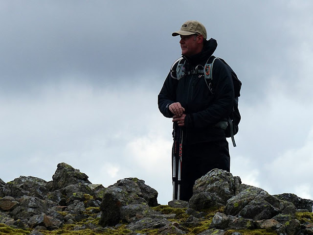
Shaun giving the thumbs up for the climb

The walk in from the car park passed the Wasdale Head Inn was a short one, so no time to warm up, briefly walking by the Mosedale Beck, we were soon on the lower slopes of Kirk Fell. The wind was picking up as we made our way up an initially grassy sloped path, and I knew the wind could be a problem higher up the fell.
Early in the climb we were joined by two guys and their dogs.
They come for a week together camping every year, we found this out through regular chats on the hillside as we gained height
.


They come for a week together camping every year, we found this out through regular chats on the hillside as we gained height
.


I’ve often found, it’s when you’re red-faced, and gasping for air, pretending to be just admiring the view on a hillside, you end up talking to strangers of a similar fitness level. And this was such an occasion.


The wind felt strong now and I almost lost my rucksacks rain cover in a gust while trying to remove it as the rain had stopped and my cover was acting like a sail, flapping in the wind as we gained height. But although it was windy, in just a matter of minutes the clouds started to lift off the peak summits and we started to see glimpses of sunshine trying to burst through the now broken cloud.

Over the next two hours, we would pass each other on the mountain, exchanging words while our heart rates came down on the now ever steepening scree.
The scree line starts about two-thirds of the way up Kirk Fell and is notoriously difficult to advance on.
For each stride up my boot made, it would slip back on the loose stone half the stride again, making the climb extremely taxing.

The two lads were telling us how they turned back during bad weather last time they were here, so when we finally reached the summit, we were all relieved.


The summit shelter was a out of the wind and sitting in it, we took the opportunity to refuel the body after one of the hardest climbs on a path in the Lake District.

The lads were soon gone, heading in a different direction to us, but then we were joined by a group of walkers from Scotland that had come from Great Gable and wanted a break from the wind.
Shaun and I chatted for too long, time was ticking on and we had a long way to go.
With my rucksack rain cover folded away again and photos taken, we were off.


Looking back at the Scottish group on Kirk Fell summit

Yewbarrow seen from Kirk Fell
Leaving the Scottish group behind, we followed the line of metal posts traversing the wide fell. These metal posts would put us in the right spot for the scramble down onto Black Sail Pass. The wind was dropping and the sun was out more than behind the clouds.
It was now 1.00pm and we hadn’t passed 2 miles yet!!!
The scramble off Kirk Fell was easy from the posts, but when we reached the bottom and looked back we thought; bloody hell!!! Completely out of the wind it was actually warm, a beautiful day was developing.


Start of the descending scramble off Kirk Fell

On the scramble down Kirk Fell to Black Sail Pass

Looking down onto Black Sail Pass from Kirk Fell
Another couple with a dog crossed our path. The chap asked what route we were taking, when I mentioned Yewbarrow he asked: ”are you going over Stirrup Crag?”
I'd planned the route but clearly overlooked Stirrup Crag. The guy gave us some tips on how to negotiate the Crag.
Pillar was our next target, heading straight to the summit rather than taking the
high-level route. Fantastic views down into the Ennerdale Valley and Black Sail Hut could be seen as we started to hop huge boulders near the top, the climb from the pass seemed to take forever, time was an issue and Shaun started to develop a cramp in his hamstrings. He assured me he would be fine, he’s had it before. But the day was clearly taking its toll and we were beginning to regret spending time on Kirk Fell.


taking a snap of the long climb up Pillar

A glimpse of Ennerdale Valley from Pillar

Looking back to Kirk Fell on the left of photo, The Scafell peaks centre

The trig point on Pillar
Wind Gap was always a bailout option if Shaun’s cramp became a problem.
We reached Pillar summit at about 3 pm but we'd only covered three and a half miles

This is where Shaun and I found the only spot of flat grass the whole day. And to mark the spot, Shaun laid down flat face down and kissed it, this is a hilly walk.
His cramp seemed to be improving, but the option of using Wind Gap as an exit down was still on offer.
We dropped down to wind Gap, and Shaun said he was happy to continue, assuring me he was fine. We then pushed on to the third fell of the day, Steeple.
A beautiful little fell, I say little but it towers over the Ennerdale Valley at 819m, but approaching from the south east it looks a delightful chocolate box of a Fell.
We were soon at the lofty summit admiring the views before moving on.


Steeple and it's stunning views

Shaun and I on Scoat Fell, the forth fell of the day
Scoat Fell and Red Pike next, Shaun and I were making good ground as we passed the 5 mile mark.
It was a long descent down to Dore Head, with Yewbarrow beyond and Shaun and I spent most of that time descending, looking at Stirrup Crag, weighing up the route we were advised to take by the couple earlier in the day.
You can’t always see these routes when you get too close to the fell. So it’s always a good idea to try and plan from a short distance away.


The winding path on the left leads to the right spot to tackle Stirrup Crag
When we finally got to the foot of Stirrup Crag, it really wasn’t obvious where on the left side we should go. This might have been the smallest Fell of the day at 627m but it needed respecting.
Unsure of where to climb, we started to look at other possibilities but all the other options looked too dangerous. It was about 6pm we were tired and I didn’t fancy the idea of finding my way off Yewbarrow in the dark.
We could have opted to go around the Fell, following ‘Over Beck’ and up the easier side of the fell, but no that wasn’t an option for us, we wanted to finish the day properly, although it was very tempting.
We went back to the left side again and Shaun spotted a possible route. This was exposed to the valley below and meant climbing out onto the exposed piece of rock before scrambling through a series of chimneys on various levels raising the heartbeat considerably.
I stayed close behind Shaun as he lead. At this point we were unsure if this was the right route or if it would allow us to climb to the summit.
Thankfully It did, and it was a relief to emerge out of the rock, adrenaline was pumping and we felt great approaching the summit, but during the scramble I tweaked my kneecap, probably due to fatigue, and fear, leaving me with an uncomfortable limp.
Quick photo on the summit, and slipped a support strap on from my first aid kit.


The summit of Yewbarrow


Light fading on an incredible day

Then we headed for Bell Rib and a slow careful scramble down some steep gullies down to Dropping Crag. It was a painful descent and I really couldn't wait to get to level ground.
Shaun who was tired but fine after his early cramp had a spray for sports injuries which he applied assuring me it will ease. It did absolutely nothing.

The only relief came when we dropped onto the road. It was about 8.30pm we still had over a mile to walk and it was now dark.
Before the long drive home, we needed some food, but by the time we arrived at the Wasdale Head Inn, they’d stopped serving hot food. We did manage to buy a sandwich in the busy bar and a soft drink.
I regretted not camping here, underestimating not just the drive, but how tough this day is. The drive out of Wasdale in darkness isn’t for the faint hearted. There is no lightning whatsoever and with only the car headlights I felt a little disoriented briefly.
I arrived home safely just after midnight, and after a few days rest the knee was fine.
What a fantastic day, tough but exhilarating. A day I will never forget.
Thanks for reading and feel free to comment
Thanks for reading and feel free to comment


