Sunday, 14 February 2016

Testing the toe on Kinder Scout


For the past 18 months or so, I've been suffering with hallux rigidus in my big toe, which is a joint problem causing inflammation and pain due to a form of arthritis. 
I'm now at a stage where I'm having an operation on the darn thing.
So without boring you too much, this would be my last hike out, until after the operation to avoid inflaming the joint before surgery. 

It was Valentine's day, and the forecast was a cold 2 degrees C, windy with snow showers later in the afternoon and temperatures dropping down to -4C on the Kinder plateau, so I wasn't expecting the sunshine and a reasonable amount of February warmth to greet me when I arrived at Bowden Bridge in Hayfield.
Avoiding the pay and display car park here and finding a free parking space along the Kinder road is never a problem, no matter how late in the morning you arrive, unlike many other parking areas of the Peak District and indeed the Lake District, you'll always find a spot along this lane, even at my 10.30am, arrival time.

I chose this route up William Clough, walking part of the Mass Trespass of 1932, where hundreds of ramblers trod in protest to highlight the restriction to roam open countryside. 
I would then traverse the western edge of the Kinder plateau, passing Kinder Downfall and leaving the tops at Red Brook returning back to Hayfield down the upper slopes of Broad Clough to Tunstead farm and the lane back to the car.


Here is the route I took, sorry for the break at the start, I forgot to start the recording, but it was 7.5 miles, walked in about 4 hours.


Once my boots were on and laced, I left the car with hard shell firmly stuffed into my pack along with hat, gloves, food, drink and a few other bits, however, I was mindful of the weight of the pack today, as I'm a bugger for carrying the kitchen sink, and a heavy load wouldn't help that toe of mine, so one or two items were left behind like the taps and plug.

There was hardly a breeze down at the foot of the mountain, as I joined the small procession of walkers all heading in the same direction along the shaded Kinder road, not quite like the Mass Trespass, but there were a few, until we passed a campsite to the right, where a number of walkers peeled off towards Coldwell Clough. 
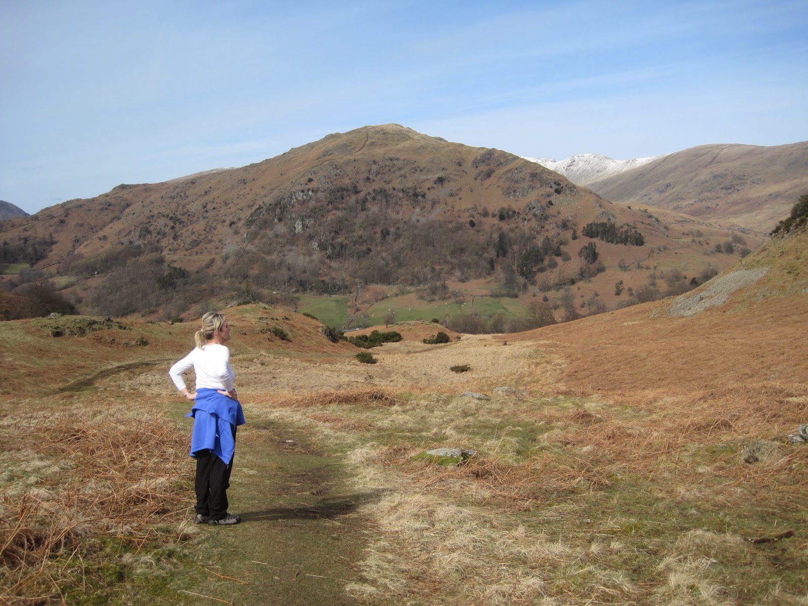
The day had a real spring feel to it and I hadn't been walking in the hills for some time now, so it felt great to be out, with the freedom of those hills in front of me I struck up a fair pace to start with, overtaking a couple of fellers as we walked by Marepiece Wood and onto the steep cobbled path, which takes you up along side the one hundred and five year old dam, which serves the town of Stockport. 

At the top of the path, I found a family of four taking a breather after the steep climb up. it's always nice to see parents taking their kids out into the hills, just as my mine took me and my sister out most weekends as kids into the Peak District, and especially the Dark Peaks.

This is the view of Kinder Scout from the lower path by the reservoir, it would be a big chunk of my walk today. Kinder Downfall can be seen on the horizon, just left of centre. 

At this point you can take the lower path, close to the water as I have, or the higher White Brow path around Nab Brow joining William Clough a bit higher up, but I prefer to be by the water. again walkers split here with some opting to take a more direct path up to the summit via Sandy Heys, a route I've not taken yet.

William Clough is a really pleasent ascent of Kinder Scout, it's a nice steady climb following the Heather lined stream that serves the Reservoir below. 
The path up the clough isn't always clear to follow, as it meanders along the waters edge, crossing from one side to the other every now and then with stepping stones to help in most parts but very enjoyable, however it's still a climb and my pace would now slow down a bit as my fitness would tell.

I was on my own now in this lower section of the clough, not another walker in sight and the clough was almost silent apart from the sound of water pouring from the small sporadic waterfalls that dot the route and my boots crunching away on the gritstone path, 
The sun was still out, my toe felt okay, so it was all good as I headed for the top.

The upper section of the clough does get a little steeper but with stone steps in place it makes it a little easier, but it still got my heart pumping at ten to the dozen and producing more than a drop of sweat off my brow, even though you could feel the temperature dropping.
The silence of the lower path was now broken by the building breeze blowing over the saddle of Ashop Head, but as I was working hard, I didn't feel it at this point. 
The ground here was frozen and it was starting to feel more like that weather forecast I'd heard earlier. 

After passing a couple of guys sat having a break before the last push up onto the plateau. I could really feel the wind getting stronger, and before I reached the Pennine Way which crosses the saddle at the top of the Clough from Mill Hill I decided to don the shell jacket and hat before I got too cold. 


Looking back down William Clough and the Kinder Reservoir in the distance


Now standing on the Pennine Way, I'm looking south east at the steepest path of the day, which puts you on the summit plateau. The last time I was here, we had deep snow and had to kick snow holes for steps up this section, no problems today though.


A panoramic shot looking south west towards the White Peaks from the Pennine Way


The frozen Pennine Way, again looking back at the Manchester skyline.

This is a typical gritstone path on Kinder, if you don't trip once on these stones during a walk up here, I'd be amazed. I swear there are little people under some stones and as soon as you look up at the view while walking, the little buggers push the stones up and they've got ya.


Heading towards the craggy Kinder Downfall about a half hour walk away

It was about lunch time now, and a couple of hours into the walk. I needed to find some shelter out of this biting wind in order to have some relative comfort eating a sandwich and a drink while I sat down for a few minutes.


Oh yeah, the perfect wind shelter.


Time to refuel with a ham salad sandwich, boiled egg and jaffa cakes............well I hadn't eaten since early breakfast.


Lovely spot in the sun, but it was colder than it looks


On a day like today, it's about taking in the views, absorb the scene and bank it into the memory..........no rush

With the lunch stop over, it was time to push on to Kinder Downfall, and after the stop I was feeling a bit chilly in the bitterly cold wind, so on went the gloves and buff.
The weather was now closing in a bit with cloud building from the east, but it was still pleasantly fresh.


Kinder Downfall, can you spot the walkers on the far side?


The frozen River Kinder.

The river, when in full flow cascades over the rocky outcrop dropping some 30 metres below.
With a strong westerly wind blowing, the waterfall flows upwards filling the air with clouds of spray. Unfortunately today it's just a trickle from under the ice, but on a plus, I stayed dry.


I'd kept an open mind on the route I was walking today, and if I felt okay, I would carry on to Kinder Low putting another extra 3 miles onto the day, but my toe was starting to bother me a bit now, so I decided to stick to the original plan of descending the plateau from the next big crag, which was Red Brook.
This path would take me down by Cluther Rocks and The Three Knolls.
It can be a tricky path to follow in mist as it's not a well used path and does disappear suddenly, then reappear, but no problem on a clear day like today.


The skyline of Kinder Scout behind me, which I've just walked from............I was happier than I looked. honest


Weather on the way in


The forecast had said snow around 3pm. The time was 2.30pm. and I was impressed, they had got that right!!!

As I got to the end of the path by "The Three Knolls" I was joined by a couple some distance in front of me. dressed in light clothes, ie  t-shirt and jeans, clearly not geared for what we were about to get dumped on us.
The young couple stood for a moment at a split in the path at Kinderlow End, then headed right towards Broad Clough. If they were heading back to a car that was parked near mine on the lane, then they had just put a half hour extra onto their shelter from the weather. I would never know.


Approaching Tunstead Clough Farm


Behind me was another couple, again some distance away, but they had clearly come down off the Kinder Plateau with more appropriate attire for a winter day in the hills.
Within a minute or two the wind had picked up to near storm force as the snow hit. I was being blown down the hill in gusts. my hat was giving me no protection on the back of my head, so as I stumbled about trying to undo the press studs of my hood, I looked around at the couple behind me, to see them doing exactly the same as me. but with a bit more success. although I did manage it eventually.
The snow shower only lasted a few minutes, but I couldn't help thinking of the poor young couple who must have been freezing and wet after a blizzard like that, 
As the wind calmed down, the couple passed me soon after, and gave me a look of wow, that was intense !!!

In the space of a few hours, I'd gone from the sunshine and calm of William Clough to a near blizzard descending this unique mountain, and although a bit over 600 metres high it's not a big hill in height, but it is a big mountain in area and should command respect. If the plateau had climbed to a summit peak, it would give any Snowdonian or Lakeland mountain a run for it's money. and indeed the plateau itself is a true test of navigation in any weather.

Back at my car, my toe felt better than expected, but I was just about on the limit of what I can do for now without too much pain. A second day on the trot out in the hills would be a painful walk for sure.
Hopefully this walk will stop the cabin fever for now. as I can now say I feel revitalized by what only the countryside can do.

Thanks for taking the time to read this, and hope it was enjoyable.


Monday, 6 April 2015

Newlands Horseshoe

My 24 year old son Jack and his girlfriend Mel had planned to visit the Lake District on Easter Bank holiday Monday, and as I'd said some weeks earlier about showing them a really good Lakeland classic when I'm fit again, I offered to take them, as this would only be their second visit to the Lakes and so not having  much of an idea where to go I was only too happy to help.

I'd settled on the Newlands Horseshoe for a couple of reasons, those being Jack and Mel had been to Keswick and walked around Derwent water, so I thought they would like a view looking down from the dizzy heights of Maiden Moor and recognise somewhere they'd been before. And secondly, five Wainwright summits I've not visited yet ha ha.


My biggest problem was getting them there early enough. Mel isn't a morning person, my sat nav read travel time 2 hrs 28mins, and we would be parking in the small car park of Little Town in the Newlands valley. Not getting parked here would mess the whole day up.
Asking two 24 year olds who work pretty hard through the week to be ready with kit for a hike at 7 am on a Bank holiday is a big ask, but any later and that last space in the car park would be gone.

I arrived outside their flat, bang on 7 am, 20 minutes later they appeared, bog eyed zombies walking towards the car. I'd given them an old rucksack each to fill with food and drink, and told them to bring a hat, gloves and waterproofs as the weather forecasters had given 9 degrees c in the valley and 4 on the top with drizzle on and off, how wrong could they be ?

We were about an hour and a half into the journey when we drove into fog on the north bound M6. It was really starting to look like a bleak day as the forecast had said. But as we reached the higher section of the motorway a few miles south of Penrith the car burst through the mist into bright beautiful blue skies and sunshine. Looking out to our left, sheets of thin layering Stratus cloud were hovering above the fells, and it looked like we could have a cloud inversion !!!
My only concern now, as we plunged back into the mist was to get parked, and get up high before the sun burned the cloud away.
Having negotiated the twisting narrow lanes in thick fog we arrived at 9.40 am and I reckon we got the 12th parking spot out of 14 .....phew! In the following 10 minutes the last two spaces were filled.

We set off from the car park still in thick mist with coats and hats on back up the lane from which we'd just driven down. It felt chilly as we made our way up our first of three climbs, this first climb was up to the saddle between Cat Bells and Maiden Moor, before turning south for the summit of Maiden Moor itself. This climb was quite a gentle ascent in general, and I thought quite easy.


          Jack and Mel just about waking up on the path up from Little Town to the saddle top


As we got nearer the top of the saddle, the sun started to shine through, and I could soon feel it heating up my back. Inevitably the shell came off, as we finally climbed above the mist into clear blue skies.


It was only when we reached the top of the saddle we could see out over Derwent Water (or not) and my hunch of a great cloud inversion, came to fruition, it was a truly wow moment, stood on the top of the saddle looking out on this amazing scene, with a huge grin on my face, I said to my son and Mel "now you see why you need to be up and out early" it really was a great reward for the early start, and so pleased I could share this amazing view with them.


Blencathra centre


  Looking north to Cat Bells and the Skiddaw range in the distance, while taking a break at Black Crag on the way up to the summit of Maiden Moor.               

Looking east towards Walla Crag


At Bull Crag we decided to take the right hand path which skirts the western edge of the fell, catching some good and now clear views of the Newlands Valley far below. Don't step back Jack.


This was taken near the summit of Maiden Moor (575m) from my camera stuck on my walking pole. 
The walk from our first Wainwright of the day to our second. High Spy was nice and easy on the wide ridge, it was at this point in the day the sun did indeed start to burn off the mist below.

It does niggle me a bit when people camp at the summit trig/cairns in fine weather. Touch it, get a snap there, then move away please, leave it clear for the next walkers to came along, rather than you having to encroach on someone's personal space to get your photo if you want one. High Spy by the way.


Looking over to Dale Head and our route ahead, the second climb of the day and for a horseshoe ridge walk, this is a beast of a climb between these two fells. You descend about 120m before climbing back up another 250m to the highest summit of the day at 753m.

It was feeling really hot now, like a mid summer's day and not a breath of wind could be felt as we passed Dalehead Tarn. The path up Dale Head is a good stone stepped one as you can see from the photo below, but it's steep, and I found it hard. Believe me, I wasn't holding back to get a good shot here, Jack and Mel were leaving me for dead.


Looking back down the path to the edge of Dalehead Tarn on the right

The wonderful Newlands Valley, and a good chance to look back on the route we've walked so far.


Now that's what I call a summit cairn, and we could still spot it almost at the car. 

Looking across to High Crag, High Stile, and Red Pike with beautiful Buttermere below, while traversing Hindscarth Edge, views of Haystacks, Pillar and even the Scafell's could be seen. but the sun was at this angle, so didn't take any shots, indeed the sun followed our left hand side all day, cooking my neck quite nicely. After Dale Head, it was an easy climb to Hindscarth, our fourth summit of the day, where we stopped for a sit down and refuel with the contents of our packs.


Taking in the views and food at Hindscarth

Mel feeling the heat and Dale Head.

The last climb of the day, our fifth summit, Robinson. Part way up this fell, if it's clear, you'll see the only cairn in sight over to the right of the path, sat on what looks like the summit, it's very tempting to take a short cut as others did in front of us, but don't, it's not the summit cairn, which the path you're on takes you to. obvious when typing this but not on the fell,


                      At the summit of Robinson, and looking forward to the scramble off here.
How many summits today John ?


Our last together shot, with Buttermere behind us. Despite the weather being hot, my son insisted on wearing his (my) shell for the last part of the walk.


Approaching the three stage scramble from Robinson


I've done a few scrambles now, but never taken any photo's during them, mainly because I might fall a long way if I got my camera out. But today I wanted a shot of these two scrambling down off this rock. I found myself a safe place to wedge into and pointed the camera. Not used to scrambles, Jack and Mel just wanted to get down off the rock alive (as Mel put it) and thus couldn't believe I was trying to record this moment of terror.
It really isn't that bad a scramble at all, that said,  care is needed and could be a bit tricky in bad weather.


Once off the rock, looking back up you do wonder how you got down it.


A view of that Dale Head climb


The 16th century Newlands Church

And a final look back on a fantastic walk.
10.8 miles later, and we were back in Little Town. It was a bit clearer now than when we left the car in the morning, giving us some great views back up the valley, and that cairn on Dale Head (centre)

As we drove up to the Swinside Inn for a steak and ale pie and a pint (lemonade and lime), before that two and a half hour drive home, I hoped I'd lit a small flame of love for this part of the world within both Jack and Mel, and hoped at some point they might just add to those five summits we visited today.

Thursday, 2 April 2015

Loughrigg Fell

Over the past few months both my wife Jo and myself have had some health issues (it's called wearing out) as you'll know if you read my last blog, I was waiting for a steroid injection in my toe joint.
Well, I finally had it done, it took some time to work, but it has worked and I'm now fit enough to get out walking again.

My wife on the other hand has been in pain for the best part of a year, with a disc pushing on a nerve, coupled with having Scoliosis (curvature of the spine) so for a spell last summer 2014 she couldn't walk more than 50 metres,
But now the disc has started to shrink a little, taking that pressure off the nerve, so she is now recovering nicely and with regular walking, slowly building her fitness again.

I've never bagged a Wainwright fell with Jo and I thought it would be nice (for me) to summit one on my birthday, it would also be a fitting start to a healthier year for both of us, fingers crossed.
Having said that, Joanne isn't a hill walker, she likes flat, short easy routes with a tearoom at the end of it, so I had my work cut out !!!

Having done some homework, Loughrigg Fell looked the best bet. Standing at only 335m it has a good path up and great views down to Grasmere. The parking (White Moss) wasn't too far away, as I was trying to keep the mileage to a minimum, which I thought was about 3.5 miles.


As it was my birthday, we didn't leave home until mid morning, you know, birthday wishes from family, card opening, texting thank you etc.....it all took time, but once we were on our way, it was only an hour and forty minutes later we were pulling up outside the Apple Pie Cafe in Ambleside for two of their lovely ham salad sandwiches, plus drinks.
The weather couldn't have been any better, warm, sunny with beautiful blue skies and hardly a breath of wind.
We arrived just after mid day in the large White Moss car park, and as we walked through the wooded area crossing the river foot bridge, I really had my doubts about my wife climbing this fell, as she is usually quite negative about climbing hills, and it did look a fair old climb to the top.
Plan B in my head, was to walk into Grasmere after walking along Loughrigg Terrace, which is where I was convinced we'd be going.

Once we were over the foot bridge, we followed  the signs for Loughrigg Terrace on a very clear wide path with a short but steep incline onto the terrace itself.
It soon became apparent that this walk was a busy and popular one, as loads of people were out walking, even on a week day as this was.


                       Jo taking a break and taking in some great views of Grasmere Lake.


Grasmere Lake and Silver Howe on the skyline


Another stop at the south west end of the terrace, and having gained quite a bit of height with an easy ascent so far, the hard work would start from here.


As you can see, it's quite a steep climb from the bottom half of the path, but it does level out a little as you near the summit. Jo was on a mission to do this having seen families of all ages and sizes spending the afternoon huffing and puffing their way up to the summit trig point. so a few words of encouragement like "Just take your time, it's not a race, we've got all afternoon" were said, in the hope she wouldn't stop and say no more. And she didn't.


Jo was doing really well, and as we got higher up the path, the views started to open up as the snow capped Langdales came into view. After this stop, by the time I had packed away my sitting mat back into the rucksack, Jo was well on her way and waiting for no one. It was at this point I began to think she just might actually make it to the top.


The views just kept getting better, as the village of Grasmere could now be seen with Helm Crag and the surrounding fells behind it. to the north Nab Scar and Heron Pike, part of the Fairfield Horseshoe.
Moments after this shot was taken a Typhoon fighter jet roared passed us, flying below our level, along the valley between Helm Crag and Seat Sandal on the right of photo.


Yeah !!! we finally made it, well done Jo, and a birthday wish comes true for me. This was my 31st Wainwright, and Jo's 1st but for all the ones I've done so far none will be more special than getting to the summit of Loughrigg Fell.

We sat down on a grassy slope, opened up the pack, and while tucking into those ham salad sandwiches, I started to think about our route down.
I could see how in low cloud, it would be very easy to find yourself heading towards Ambleside or worse Skelwith Bridge, when wanting to head for White Moss, without a GPS as several paths lead off the summit in all directions amongst many small hills.

Jo was happy to return the way we came, along with the masses, rather than the quieter south east side, but I felt the very steep descent that we climbed would be hard on her knees and back going back down that way, unlike the much steadier descent of my planned route.


As we left the summit, I felt a bit of pressure to get the navigation right, and drop back down on the right path so as not to add any more miles than necessary.
For all the times I've left home to climb mountains, I tell Jo "don't worry, I know what I'm doing" so to fail at this little fell would put a big question mark over how safe I am on solo walks in my wife's eyes.


Jo was getting a little nervous as not another walker had been in sight for some time. and was starting to question whether this way down was longer, but before I could answer, we spotted a farmer trying to round up his sheep with his I would presume young son and a dog.
"Ah civilisation" I joked, assured that we were on the right path I could now relax a bit.


Dropping down to Jobson Close, we joined the families with pushchairs on the stone laid path, which led us to the beautiful Rydal Cave. As you can see from the photo, you can use the stepping stones to get to the dry far end of the cave. This really is a stunning area, and no wonder Wordsworth came to live in the area.


At the end of the walk, which was more like 4.5 miles, Jo was tired, but most importantly she had enjoyed it, and felt proud to have climbed a fell at all. It didn't matter that it was a small one as it's all relative to each persons goals, and for Jo, that was a big step.


All that was left to do, was check in at the B&B, shower then meal and a little birthday drinkies.....perfect