I was returning to Helvellyn today for only the second time. It’s where my passion for the Lake District all started, traversing “Striding Edge” with a work colleague six years earlier. From then on, I wanted to go on and explore every corner of this beautiful national park, I’m getting there...........but slowly.
This route I’d planned today would be ambitious for me, nine summits in about 12 tough miles.
I’d be setting out from Patterdale, heading up to Anison Crag, then onto Birks followed by St Sunday Crag, crossing Deepdale Hause, bypassing Cofa Pike and skirting Grisedale Tarn before climbing Seat Sandal. From here a climb onto the Helvellyn range, first stop being Dollywaggon Pike, then Nethermost Pike, before finally reaching Helvellyn itself.
After the tricky down scramble of Swirral Edge, I’ll nip up to Catstye Cam and head down to Patterdale via Birkhouse Moor.
An epic day ahead.
 The intended route
In the days leading up to my trip, Saturdays weather forecast was terrible with high winds and rain. Sunday was a gloomy start with early morning rain forecast, but brighter in the afternoon. So at the last minute, I booked overnight accommodation at the Helvellyn YHA for Sunday evening and booked a day off work for Monday.
This would allow me to walk the better albeit wet start to Sunday, stay over and get another hike in on Monday.
As first light broke at a little after 7am Sunday morning on the M6, I could see the cloud base seemed high, certainly didn’t look like rain. Traffic was light and I was making good time. I was out of bed at 5am and away from home before 6am hoping to get an 8.30am start allowing plenty of time to achieve the goals of the day before nightfall.
All was going to plan until I approached junction 36 on the M6 where I was met with a road closure sign for the A591. “Surly not my route” I thought as I exited the motorway, but sure enough I was forced off the carriageway of the A590 by a line of traffic cones at Sizergh onto a roundabout. “Bloody hell!!!”
I have no knowledge of this area, only the route into the Lake District. With no diversion signs to help, my gut instinct told me left off the roundabout, and head southwest.
The road closure was due to flooding I think, and for the next hour of driving I would experience such flooded roads as I made my way along the A5074 into Bowness-on-Windermere, before heading over Kirkstone Pass arriving in Patterdale half an hour later than planned.
It was no big deal, I had all day and I wasn’t driving home after the walk thank goodness. So I parked in the decent sized Patterdale Hotel car park which is just across the road from the hotel, paying £4.50 for the day.

My rucksack was heavy today, although 8 Celsius by the Lake, temperatures on the summits could go down to 3C with the possibility of sleet the forecast stated, so I was carrying hat, gloves, waterproof pants, survival bag, 2Ltrs of water plus bottle of orange juice, food for the day, a few bits and bobs plus my dslr camera.
The start of the walk took me past the “White Lion” pub in a very quiet Patterdale just before 9am. turning right, up a lane by the pub car park passed a row of properties and onto a woodland path towards Glenamara Park. Easy going to start with, which is always nice with cold and stiff leg muscles after the drive and carrying a heavy rucksack. The weather looked promising and currently dry, feeling quite warm.


The month of October sees the bracken brown with contrasting green grasses lining the route and fantastic autumnal rich colours on the fell sides.
The path soon peels away left by a wall which borders Glenamara Park and climbs steeply away, towards “Oxford Crag”
 Glenamara Park beyond the gate and the path left following the wall
 The path follows the wall passed "Oxford Crag"
Looking back, views of Ullswater could be seen and the sound of voices through a megaphone were heard in the still air from the direction of the lake. I wondered if a fell race was being organised. With selfish thoughts I was hoping not, I was enjoying the peace and tranquillity of the fells which up to now, I’d had all to myself having not seen another walker since my start in Patterdale.

I soon arrived at the rocky outcrop of Anison Crag standing at a modest 433m, it has a fantastic view point of Ullswater and Glenridding, and although this point is lower than the surrounding fells, the views it affords of Place Fell, Angle Tarn Pikes, High Raise, and High Street in the East are still good. I also had a good look at tomorrows walk on Hartsop Dodd, Gray Crags and Stoney Cove Pike. And to the south the gentle ascending ridge of “Hartsop above How” I wanted to capture it all, getting my camera out of the pack I started to play around with it on manual for far too long, trying to achieve a good shot without real success. With a damp feel in the air, I finally put the camera away, realising I had a long way to go and it was almost 10am. I swallowed a couple of jelly babies and had a much needed pee behind a rock before marching on towards “Birks”
 The summit of Anison Crag
I made my way across the bumpy grass tops rounding “Trough Head” then followed a broken wall up a steep rough path strewn with rocks to the grassy summit of “Birks”
 The view of Ullswater while rounding "Trough Head"
 The path up to the summit of "Birks"
Here, the previous days rainfall was evident in the White waters flowing off of the fells of “Birkhouse Moor” to the north and off “Hartsop above How” into “Deepdale Beck” to the south, but thankfully the rain was holding off so far today. From here on “Birks” I could see the skyline had an uncertain look about it. Low clouds loomed in the east of the park but today’s weather would be coming in from the west, which looked brighter, the odd low floating cloud drifted below distant summits, But I felt it could rain any time soon so I left my soft shell jacket on, and the camera stayed in the pack.
 The view from "Birks" summit shows from left to right, Nethermost Pike, Striding Edge, Catstye Cam popping up in the centre and Birkhouse Moor to the right.
 Views north show Glenridding Dodd (left) separated from Place Fell (right) by Ullswater
Apart from the views, the summit of Birks itself is pretty dull, with just a very small cairn marking the summit, which is surrounded by some pretty flat grassy fell top.
My stay here was brief, wanting to make some time up, I’m not a fast walker, and I like to enjoy the surrounding views by stopping every few minutes whether I need a breather or not, just to take in the view, but I didn’t want to find myself pushed for daylight later in the day.
 View southwest from Birks, looking at my route up St Sunday Crag
 Herdwick lambs are so cute
After leaving the summit of Birks, two older guys I presumed to be father and son I think, caught me up as I took a breather before the climb up onto St Sunday Crag. We had a quick chat about yesterday’s weather, they told me how bad it had been while they were on Sheffield Pike, with wind and rain and decided to have an early pint in Glenridding .
That news made me feel I’d made the right call, delaying my walk until today. These guys were heading to Fairfield with one very light rucksack between them. I felt I had a small child on my back in comparison as I slid it off my back for a quick snack and a swig of fresh orange juice from a side pocket. I had water in my drinks bladder, which is fine while walking, but it’s nice to have something tastier with food, without sucking from a tube.
It was a 240m climb from here to the summit, so with the small child back on my back, I made the slow climb up onto St Sunday Crag. By the time I reached the twin cairn summit at 841m the two guys ahead of me were out of sight and once again I had the fells to myself.
 Guided by the cairns the summit nears
 Views northeast from St Sunday Crag
 The two cairns mark St Sunday Crag summit
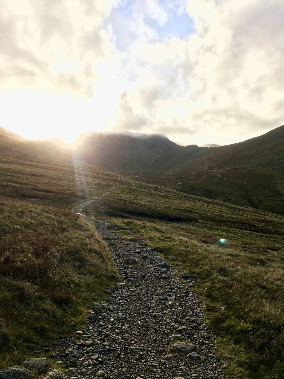
From here I could see almost all the days route as I looked along the ridge of Deepdale Hause, I thought “wow”, this would be a big test. You can look at the contours of a map for as long as you like, but nothing beats looking at the mountains in situ to make you realise what effort will be required to finish a walk. I could see from Birkhouse Moor “Striding Edge” Helvellyn, Nethermost and Dollywaggon Pikes, I could even see Catstye Cam popping up on the skyline. In front of me was Fairfield and Grizedale Tarn and beyond those, my next goal, Seat Sandal.
 Similar view from "Birks" northwest but now Helvellyn summit can be seen
Cofa Pike looked an interesting route up to Fairfield from the Hause but having done the Horseshoe route, Fairfield wouldn’t play a part today, not that I didn’t have enough to go at!!!
As I walked the excellent Deepdale Hause, stunning views of the craggy northeast side of Fairfield, Black Buttress, Hutaple Crag, Black Tippet and “The Step” down to Greenhow End could all be seen, but my eyes were drawn to Dollywaggon Pike and that pretty stiff climb which was to follow. Below the pike was the clear path following Grisedale Beck back down to Patterdale and this was my bailout route should I need to take it.
 Fairfield and the "The Step" a tongue off the craggy east side
 Looking west, Fairfield (left) Dollywaggon Pike (right) and Seat Sandal (centre)
 Grisedale Tarn comes into view and Cofa Pike to the left with Seat Sandal beyond
Just then a springer spaniel ran passed me with one of those mountain dog harnesses on, and I immediately looked around to see a young woman running towards me. With a nod and a smile she was passed me running down the steep path to Grisedale tarn.
It always amazes me just how fit some people are, and especially fell runners, they are just a different breed. the dedication needed to maintain that level of fitness is astonishing. She was clearly carrying just the basics water etc as she only had a tiny bumbag ........
 The steep path off Deepdale Hause down to the tarn
 Clouds forming over Helvellyn

As I approached Seat Sandal, predictably the routes off Fairfield were busy with groups of walkers and here at the junction called Grisedale Hause most walkers were passing through on their way up from Tongue Gill or dropping back down the route to the A591 below from Fairfield, or heading for the zigzag path onto Dollywaggon Pike.
 My climb up Seat Sandal
The climb up Seat Sandal from here was steep scrambling scree, short energy sapping climbing. I was the only one doing it. I put my poles away for the climb so I could use my hands. A number of slips and breathers later, surprisingly I soon gained the summit at about 1.15pm where I joined an elderly couple at the stone cairn, they had made the climb from ‘Dunmail Raise’. A lovely couple and very pleasant.
We had a chat for a few minutes as they asked where I had walked from and going to. They seemed surprised to hear I’d set off from Patterdale.
I left them admiring the now excellent views west. The Old Man of Coniston, Langdales and Scafell Pike were on view with sunshine spraying them in patches as the cloud broke. Further north west the Central Fells, all looking stunning in a panoramic scene as the blue sky started to dominate. A stark contrast to my route onto Helvellyn as the peaks of this mountain range were in cloud.
 Looking back at St Sunday Crag (centre) and to the right, Fairfield now in cloud
With poles back out I crossed a broken wall then followed it down off Seat Sandal heading north back down towards the tarn, and at this point, I should have gone around the tarn and joined the easier zigzag route up Dollywaggon Pike, but instead having crossed the boggy depression, I took the shorter direct approach following a broken wall, not really a path but it had occasional boot divots amongst the stones in the hillside.
 Following the wall off Seat Sandal with Dollywaggon Pike ahead
 The foot of Dollywaggon Pike and the route I took by the wall on the left
 Admiring the views out west to the Central Fells while catching my breath
I knew if I could climb this fell I would gain another four summits very easily with very little climbing for the rest of the day with the promise of fabulous scenery. And while I dug deep on this killer steep climb the clouds just started to dissipate and the sun shone through, like the gods were saying well done feller here’s your reward. My jacket came off at this point and was stuffed into the rucksack, But the climb was still a sweaty effort. By the time I reached a very ornate post marking a crossroads I was extremely hot and sweaty, unlike most of the folks on this main highway, both casual and serious walkers, couples holding hands and some without a bag between them, families and groups. All passed from left to right, and right to left. No one was heading straight on. But straight on was Dollywaggon Pike summit, and I continued across, having recovered from that killer climb with a small child on my back named Osprey Talon.
When I finally arrived at the grassy dome of the 858m summit I was wanting a sit down for a rest but a couple were kissing and just generally loitering around the cairns making me feel uncomfortable, one small one, the cairns that is, not the couple, and a larger cairn to the West mark the summit.
 Dollywaggon Pike summit, looking West, and wow what a day I was now having
 Looking East Birkhouse Moor (left) Place Fell (centre) St Sunday Crag (right)
 Looking beyond St Sunday Crag to Gray Crag Hartsop Dodd and High Street
The views I had were magnificent, and I felt rewarded for the effort to get here, I could have so easily have been following Grisedale tarn far below me now back to Patterdale.
I stuck around for a few minutes and the couple eventually strolled off in the direction of ‘High Crag’ so I parked my backside down for a well earned rest, tucking into a ham and egg sandwich, a packet of crisps and a banana, facing High Crag, while finishing off the orange juice in the warm sunshine. “SLEET!!!” I thought, how wrong was today’s forecast. There I was with waterproof pants, hat gloves and the kitchen sink, I was sunbathing, but you can never predict the weather all the time.
 The picnic
 High Crag and Nethermost Pike

Bagging the empty packet of crisps and the banana skin before packing them into my dry bag. It was 2.20pm and I’d covered about 6 miles. I’d reached five summits with four more to visit, so my seat matt was folded away and feeling the energy levels rising again I headed north, joining the many on a well established track.
I stayed on the main trail bypassing High Crag, but then peeled off across a wide expanse of almost flat ground to reach the cairn marking “Nethermost Pike” in a grassy field of rocks.
A brief stop for a photo and my march continued aware that time was ticking by, it was 3.15pm I still had about 6 or 7 miles to cover with about 3 hours of daylight left, as I said I’m not a fast walker.
 Nethermost Pike summit at 891m
 View of Striding Edge and Grisedale Beck below from Nethermost Pike
 Helvellyn ahead, Striding Edge to the right and Catstye Cam beyond
It’s a long gentle climb to Helvellyn, almost a stroll in the park over the broad grass top. I passed the commemorative plaque to John Leeming and Bert Hinkler who landed an Avro 585 Gosport aeroplane in 1926 on this very spot, funnily enough the plane flew from Woodford in Cheshire, which is about a ten minute drive from my home.
 The commemorative plaque
 Looking back South to Nethermost Pike from Helvellyn
 Helvellyn summit shelter ahead
I looked on at “Striding Edge” with fond memories of Andy and myself crossing this brilliant ridge, and thought to myself I must do it again soon.
I passed the busy summit shelter and went to the trig point, the only one on today’s route. Again views all afternoon were outstanding and Helvellyn has some of the best although views opened up to the north, I could see Blencathra and the surrounding fells still had cloud formations over their tops.
 Helvellyn trig point and to the right my descent route on Swirral Edge
Leaving Helvellyn’s summit passing two lads with a drone, I packed my walking poles away on the back of my rucksack again and made my descent down Swirral Edge, care is needed on this down climb, a stumble here could be serious, easily done with tired legs, hands are needed so slow and steady I made my way down, it was trickier than I remembered from my last visit.
 The view looking down Swirral Edge at Catstye Cam
 Looking back up Swirral Edge

 Red Tarn and Striding Edge
But safely down I was soon at the climb for Catstye Cam where poles came out again.
While making this climb I heard the humming of that drone over head, flying over Catstye Cam before returning to the Helvellyn summit. You never know, I might have been filmed climbing the little peak.
The sun was getting low as I made the summit of Catstye Cam. Again a brief stop was made here.
 The cairn on Catstye Cam offering views of Birkhouse Moor and Sheffield Pike
I had spotted the dam at the foot of “Keppel Cove” far below and wanted to get a better photo, and without thinking or more to the point checking the map, I headed off the summit east. I got a shot of the dam and continued down hill, soon realising this would put me on the wrong path for “Birkhouse Moor” to cut across wasn’t an option as it was marshy ground. I should have returned back the same way I climbed the fell and rejoined the Swirral Edge route down, but it was too late, I’d dropped down too far to return.
 That dam

As I dropped down off Catstye Cam my returning path just got lower and lower, I was a little bit annoyed with myself for the simple error, I’d had very little navigation to do all day as my route was pretty obvious and I got careless. I was annoyed because I’d covered about ten hard miles, in reality I had another 6 miles to walk and I had tired legs, light was fading but I WAS going to Birkhouse Moor even if it meant with a bloody head torch on!!!
Okay, calm down John.......remember you do it for pleasure. I finally dropped back onto the path by “Red Tarn Beck” and reluctantly started the short climb back up to the tarn itself, crossing the water and following a couple who’d just descended “Swirral Edge” they must have wondered where I had come from, but I was now back on track.
 cloud forming over Helvellyn gives it an atmospheric feel
The sun was setting behind me as I followed the path to the wall and a stile. The couple ahead of me disappeared over the stile heading down. I then followed the wall along the easy flat grassy path to the cairn which marks the highest spot for Birkhouse Moor, however, I spotted a large cairn a little further away. So just to be sure I was at the highest point I went to this one as well.

 The setting sun on Birkhouse Moor, not the official cairn, but takes a better photo than the highest point which is by the wall.
The sky was pink over Ullswater as the setting sun brought the end of what had been a fantastic mountain day, excellent views could be seen down into Glenridding as I noticed street lights were now on, I could see cars with headlights on. It was well and truly dusk, all I needed to do was get down to Patterdale.
I returned to the cairn by the wall, and followed the wall down to a point were a path branched off over the wall to the right. The path I was on led to Glenridding so I needed this branching path which joins up with one from the “Hole-in-the-Wall” that would take me back to Patterdale.
 Following the wall down from Birkhouse Moor looking for that right turn
 My photo of the day
 Moons out over St Sunday Crag
Having crossed the wall. The path was faint, I followed it for a time and this path just became brushed flattened grass, barely a path at all. Certainly not used frequently. I had no chance of following this with a head torch in the dark and my heart rate started to rise, I needed to pick up that path somewhere below me while I could still see. With no choice but to continue while scanning the hillside below me for signs of that path.
Suddenly I spotted a patch of sand coloured stone below, that’s the path. The choice was risk following the route I was on in the dark, or cut down through the thick bracken while i had some dim light as it looked reachable.
So I came off the path I was on and dropped through the bracken with a few slips here and there I made it onto the main path with some relief, as it was now pretty dark.
Head torch went on and a little red flashing doggy light clipped to the slightly lighter child named Asprey Tallon, due to the lack of food and water making it lighter. I had a lane to walk back into Patterdale and I’m sure the drivers of the three vehicles that passed me appreciated the fact I played my part in not getting run over.
I followed the lower section of the “Hole-in-the-wall path down in the dark by torch, crossing the bridge over Grisedale Beck and down the said lane, coming out opposite Grisedale Lodge, leaving just the short walk back along the A592.
I arrived back in Patterdale at 7pm just under 16 miles later, with eight new Wainwright summits now totalling 122 with 92 left to climb, I was damn pleased with myself.
 Almost down

Having dumped my gear at my dew covered car, I had fish and chips over a pint of “Moretti” larger in the “White Lion” pub, they didn’t have any steak and ale pie left, which I was hopping for.
The pub was quiet as you’d expect on a Sunday night, all but for a couple of ladies talking about their experience on the “Camino de Santiago” walk, but the pub was decorated very nicely for Halloween.
 Now that was a well earned pint
 Indeed
I didn’t dare have another drink, I allow only the one while driving and I had to get halfway back up a mountain.
Helvellyn YHA is in the middle of nowhere. Well actually it’s just below Sheffield Pike and Birkhouse Moor, had I not needed the car I could have walked there, anyway it’s on the bumpiest single track road I’ve ever been on. £21 for the night, £70 for new shock absorbers? I say with a smile. You just need to drive slowly. I just didn’t want to meet anyone coming towards me, as there are few passing places.
When I finally got there, I turned the car headlights out and I have never seen darkness like it. Looking up, the stars were amazing to see, but as stunning as they were, my bed was calling.
 That road up to Helvellyn YHA
A short walk from the car park with my head torch on and the comfort of lights could be seen. And I clambered down the path with my overnight bag. A row of boots rested by the doorway. A proper old hostel, full of character, in a good way.
“John is it?” The reception manager asked, and I quickly checked in showing my drivers license. the place just like the pub was dead except for a few more senior ladies.
 This hostel is in an amazing location
It wasn’t long before I was in my private room and in my bottom bunk bed and out for the count. Zzzzzz

The intended route


Glenamara Park beyond the gate and the path left following the wall

The path follows the wall passed "Oxford Crag"
Looking back, views of Ullswater could be seen and the sound of voices through a megaphone were heard in the still air from the direction of the lake. I wondered if a fell race was being organised. With selfish thoughts I was hoping not, I was enjoying the peace and tranquillity of the fells which up to now, I’d had all to myself having not seen another walker since my start in Patterdale.


The summit of Anison Crag

The view of Ullswater while rounding "Trough Head"

The path up to the summit of "Birks"
Here, the previous days rainfall was evident in the White waters flowing off of the fells of “Birkhouse Moor” to the north and off “Hartsop above How” into “Deepdale Beck” to the south, but thankfully the rain was holding off so far today. From here on “Birks” I could see the skyline had an uncertain look about it. Low clouds loomed in the east of the park but today’s weather would be coming in from the west, which looked brighter, the odd low floating cloud drifted below distant summits, But I felt it could rain any time soon so I left my soft shell jacket on, and the camera stayed in the pack.

The view from "Birks" summit shows from left to right, Nethermost Pike, Striding Edge, Catstye Cam popping up in the centre and Birkhouse Moor to the right.

Views north show Glenridding Dodd (left) separated from Place Fell (right) by Ullswater

View southwest from Birks, looking at my route up St Sunday Crag

Herdwick lambs are so cute
That news made me feel I’d made the right call, delaying my walk until today. These guys were heading to Fairfield with one very light rucksack between them. I felt I had a small child on my back in comparison as I slid it off my back for a quick snack and a swig of fresh orange juice from a side pocket. I had water in my drinks bladder, which is fine while walking, but it’s nice to have something tastier with food, without sucking from a tube.
It was a 240m climb from here to the summit, so with the small child back on my back, I made the slow climb up onto St Sunday Crag. By the time I reached the twin cairn summit at 841m the two guys ahead of me were out of sight and once again I had the fells to myself.

Guided by the cairns the summit nears

Views northeast from St Sunday Crag

The two cairns mark St Sunday Crag summit

Similar view from "Birks" northwest but now Helvellyn summit can be seen
Cofa Pike looked an interesting route up to Fairfield from the Hause but having done the Horseshoe route, Fairfield wouldn’t play a part today, not that I didn’t have enough to go at!!!

Fairfield and the "The Step" a tongue off the craggy east side

Looking west, Fairfield (left) Dollywaggon Pike (right) and Seat Sandal (centre)

Grisedale Tarn comes into view and Cofa Pike to the left with Seat Sandal beyond
Just then a springer spaniel ran passed me with one of those mountain dog harnesses on, and I immediately looked around to see a young woman running towards me. With a nod and a smile she was passed me running down the steep path to Grisedale tarn.

The steep path off Deepdale Hause down to the tarn

Clouds forming over Helvellyn

As I approached Seat Sandal, predictably the routes off Fairfield were busy with groups of walkers and here at the junction called Grisedale Hause most walkers were passing through on their way up from Tongue Gill or dropping back down the route to the A591 below from Fairfield, or heading for the zigzag path onto Dollywaggon Pike.

My climb up Seat Sandal

Looking back at St Sunday Crag (centre) and to the right, Fairfield now in cloud

Following the wall off Seat Sandal with Dollywaggon Pike ahead

The foot of Dollywaggon Pike and the route I took by the wall on the left

Admiring the views out west to the Central Fells while catching my breath

Dollywaggon Pike summit, looking West, and wow what a day I was now having

Looking East Birkhouse Moor (left) Place Fell (centre) St Sunday Crag (right)

Looking beyond St Sunday Crag to Gray Crag Hartsop Dodd and High Street

The picnic

High Crag and Nethermost Pike


Nethermost Pike summit at 891m

View of Striding Edge and Grisedale Beck below from Nethermost Pike

Helvellyn ahead, Striding Edge to the right and Catstye Cam beyond

The commemorative plaque

Looking back South to Nethermost Pike from Helvellyn

Helvellyn summit shelter ahead

Helvellyn trig point and to the right my descent route on Swirral Edge

The view looking down Swirral Edge at Catstye Cam

Looking back up Swirral Edge


Red Tarn and Striding Edge
But safely down I was soon at the climb for Catstye Cam where poles came out again.

The cairn on Catstye Cam offering views of Birkhouse Moor and Sheffield Pike
I had spotted the dam at the foot of “Keppel Cove” far below and wanted to get a better photo, and without thinking or more to the point checking the map, I headed off the summit east. I got a shot of the dam and continued down hill, soon realising this would put me on the wrong path for “Birkhouse Moor” to cut across wasn’t an option as it was marshy ground. I should have returned back the same way I climbed the fell and rejoined the Swirral Edge route down, but it was too late, I’d dropped down too far to return.

That dam

As I dropped down off Catstye Cam my returning path just got lower and lower, I was a little bit annoyed with myself for the simple error, I’d had very little navigation to do all day as my route was pretty obvious and I got careless. I was annoyed because I’d covered about ten hard miles, in reality I had another 6 miles to walk and I had tired legs, light was fading but I WAS going to Birkhouse Moor even if it meant with a bloody head torch on!!!

cloud forming over Helvellyn gives it an atmospheric feel

The setting sun on Birkhouse Moor, not the official cairn, but takes a better photo than the highest point which is by the wall.
The sky was pink over Ullswater as the setting sun brought the end of what had been a fantastic mountain day, excellent views could be seen down into Glenridding as I noticed street lights were now on, I could see cars with headlights on. It was well and truly dusk, all I needed to do was get down to Patterdale.
I returned to the cairn by the wall, and followed the wall down to a point were a path branched off over the wall to the right. The path I was on led to Glenridding so I needed this branching path which joins up with one from the “Hole-in-the-Wall” that would take me back to Patterdale.

Following the wall down from Birkhouse Moor looking for that right turn

My photo of the day

Moons out over St Sunday Crag

Almost down


Now that was a well earned pint

Indeed

That road up to Helvellyn YHA

This hostel is in an amazing location
No comments:
Post a Comment